Carrizo Plain Wildflowers: Temblor
Range, San Luis Obispo County
By Jack Elliot January 17, 2011 (with some additions)
The
Carrizo Plain was officially designated a National Monument a decade ago today
on January 17, 2001.

Vast. Silence.
Perhaps no two words more aptly
describe the Carrizo Plain. As I stopped the engine and stepped from my truck I
was struck by its immensity. The dirt road shot out before me into a needle
point, far-off in the shimmering distance to the north, crossing the San
Andreas Fault and disappearing at the base of the Temblor Range.
The sun-baked grassland swept
westward, its individual stalks melting into the solid color of an immeasurable
distance, and then abruptly stopping in a flat line where it met the faded,
pastel blue of the horizon.
So this is what
the Golden State’s 400-mile long San Joaquin Valley once looked like, I thought, as I stood alone with my ears ringing from a
silence that seemed to press in on me.

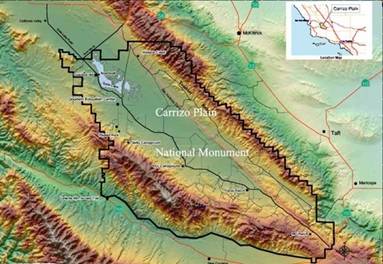
Tucked away in the southeastern corner
of San Luis Obispo County, the monument spans a quarter of a million acres of
grasslands and rolling mountains. Sometimes called California’s Serengeti, this
Golden State savannah offers refuge to an impressive list of large mammals
including pronghorn antelopes, Tule elks and San Joaquin kit foxes to name just
a few. Hawks, eagles and falcons soar through the thermals overhead, while the
seasonal wetlands of Soda Lake attract numerous species of migratory
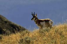
birds including thousands of sandhill cranes. Pronghorn antelope on the Carrizo Plain, the second fastest mammal on
Earth slower only than the cheetah, but can actually run at a faster sustained
sped than cheetahs.


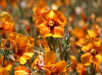
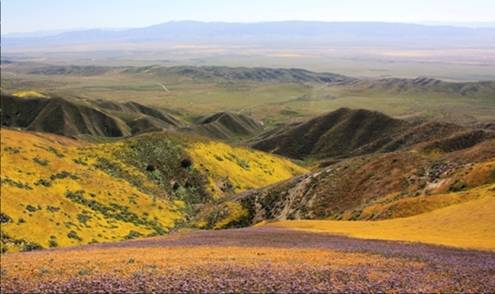
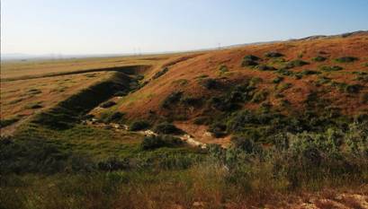
One of the more spectacular, yet
fleeting, displays of the Carrizo’s grandeur comes in late winter and early
spring. In March and April, the Temblor Range explodes in a glorious profusion
of wildflowers. The annual bloom varies in intensity and timing depending on a
variety of seasonal fluctuations, but for a few weeks the steep slopes of the
hilly country transform into a polychrome patch work of brilliant color. The
ephemeral burst grows thick enough to be seen for miles, which makes locating
the sites with the best and heaviest blooms fairly easy.
Elkhorn Road runs along the base of
the Temblors and provides excellent views of the flowers from a distance. A few
other roads wind their way through and over the steep hills, the north facing
side of which is lightly wooded. The roads in among the hills can get really
steep and narrow and are at times little more than a Jeep trail in some
particular places. I put my truck in 4×4 just so I was not constantly spinning
my tires on the steep, hard packed grass covered dirt. Last year I was a bit
late making it out to there, though, and the wildflowers had already hit their
peak perhaps a week or two before.


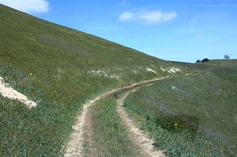
A narrow road leads through the
Temblor Range and winds its way along the seam between two mountains.
A stretch of road running across the
grassy slopes on top of the Temblor Range.
The
view from on top of the Temblor Range overlooking the Carrizo Plain.


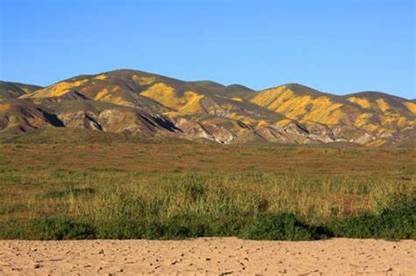
A
view of the Temblor Range from Elkhorn Road.

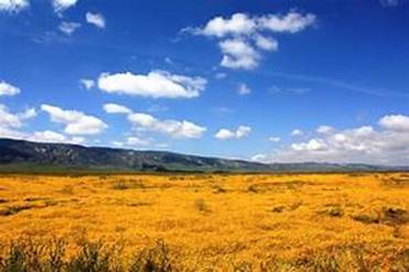
The flatland of the Carrizo Plain in
bloom with the Caliente Range in the background.
Access
to Elkhorn Road along the foot of the Temblor Range from Highway-33 or
Highway-58.
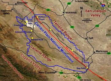
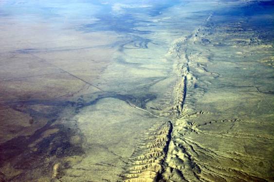
Red
line just west of the Temblor Range?
That’s our own
San Andreas Fault!
The aerial photos tell the story…
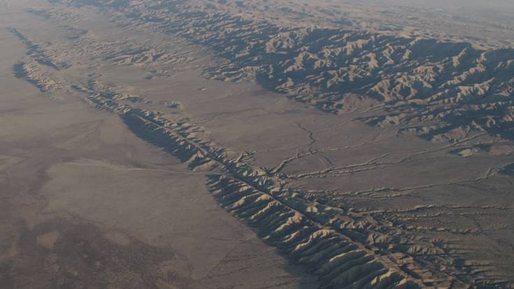
Would you like to see a ‘Right-slip Fault’?
Take a look at the famous Wallace Creek!
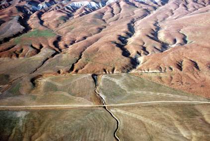
The Temblors keep slipping south or ‘right’
and Wallace Creek has a stream offset!
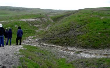
Now if you stand on the Temblor side of the
fault…
it’s the Carrizo Plain which is slipping
north or ‘right’ & blocking and turning the creek flow!